| Weather Data | |||
|---|---|---|---|
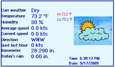
| LAST READING AT TIME: 18:30 DATE: September 17 2009 | |||
| Current Weather | Dry | Current Temperature | 73.2 °F(Heat Index 76.5 °F ) |
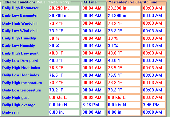
| Maximum Temperature (since midnight) | 73.2 °F at: 00:04 AM | Minimum Temperature (since midnight) | 73.2 °F at: 00:04 AM |
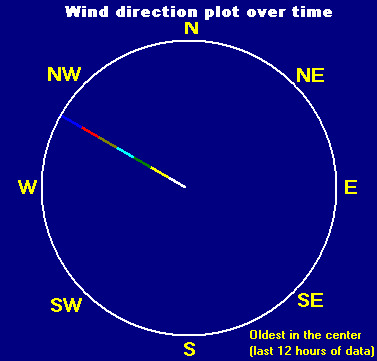
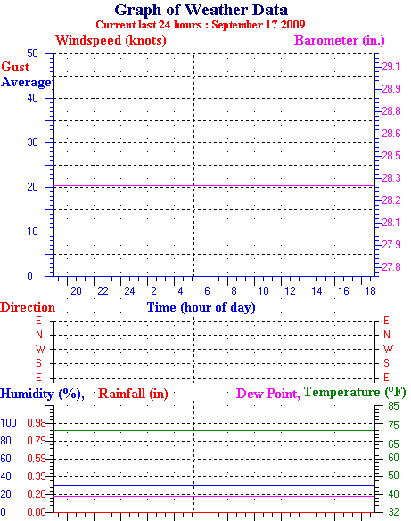
| Average windspeed (ten minute) | 0.0 kts (0.0 kmh) | Wind Direction (ten minute) | WNW (292ş) |
| Windchill Temperature | 73.2 °F | Maximum Gust (last hour) | 0 kts (0.0 kmh) at: 6:00 PM |
| Maximum Gust (since midnight) | 0 kts (0.0 kmh) at: 00:00:00 | Maximum 1 minute average (since midnight) | 0 kts (0.0 kmh) at: 00:00:00 |
| Rainfall (last hour) | 0.00 in | Rainfall (since midnight) | 0.00 in |
| Rainfall This month | 0.00 in | Rainfall To date this year | 3.56 in |
| Maximum rain per minute (last hour) | 0.00 in/min | Maximum rain per hour (last 6 hours) | 0.00 in/hour |
| Yesterdays rainfall | 0.00 in | DewPoint | 40.0 °F (Wet Bulb :56.7 °F ) |
| Humidity | 30 % | Barometer corrected to msl | 28.290 in |
| Pressure change | 0.00 in/ (last hour) | Trend | STEADY |
| Pressure change (last 12 hours) | +0.00 in | Pressure change (last 6 hours) | +0.00 in |
| Maximum soil temperature (since midnight) | 42.6 °F | Minimum soil temperature (since midnight) | 42.6 °F |
| Current Soil temperature 42.6 °F | |||


Use the RELOAD facility on your browser to retrieve the latest data.